As a visitor to this website, you may have wondered how I got into such a specialised hobby as photographing transmitter sites. There are many reasons why I have been pursuing this hobby for years. On this page I would like to give a little insight into the ‘development’ of the transmitter photography hobby and explain why simple metal masts exude a fascination for me and why this hobby even contributes to the expansion of my own knowledge.
The development of the radio section of alpemare.eu

One main component of this website is a section dedicated to various aspect of radio in the Alpe-Adria region, from the history to current stations to more technical aspects such as long-distance receiving of (FM) radio stations. One section is also dedicated to show pictures of various radio stations all over the region and beyond.
This website has started in 2009. At that time, I officially registered the website www.alpe-mare.de (later alpemare.eu) and started setting it up. Originally, the focus of the website was not to be on station photos at all, but on information, band scans and news from the radio world in the Alps-Adriatic region (Carinthia, Styria, Slovenia, Croatia, north-east Italy).
Alpemare stands for the Alpe-Adria region. alpe for the Alps and mare (Italian for sea), for the sea. Together they are intended to summarise the diversity of the region in one short word – Alpemare. On this page I explain what can be fascinating in taking pictures of transmitters and in general why even in times of internet and streaming catching for radio stations from far away can be quite interesting – and another way to better understand Europe.
‘It’s just a bit of metal’ – about the fascination of transmitter sites
Many people have often asked me what can be fascinating about taking pictures of transmitters. Research, travelling, which of course costs fuel + time, post-processing with programs like Photoshop and of course the publications on this website – and all this just for ‘a bit of metal!
Of course – photographing transmitters will probably never be everyone’s cup of tea. For me, however, there is more to it than meets the eye. The following points will try to give you an idea of my motivation and enthusiasm:
A: Photographing transmitter sites perfectly aligns with the hobby of ‘travelling’
Travelling has always been one of my greatest hobbies. Planning tours with hundreds of maps, atlases and travel guides (don’t forget that there was a time before Google Maps) was one of my favourite pastimes.
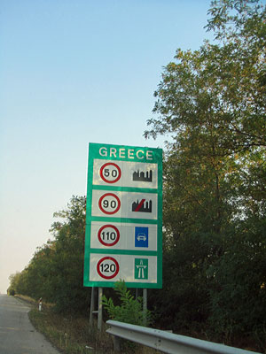
Travelling somewhere as often as possible, discovering new landscapes, new regions and cities, broadening my horizons – there are many reasons why I like to travel. I primarily follow the motto ‘Travelling educates!’. You return slightly changed from every journey. Even if you don’t realise it, the many new impressions and experiences have shaped you and even ‘formed’ you a little more. Every journey, no matter where you go, contributes to this.
Travelling as a hobby has therefore always been very important to me, as transmitters are known to be located in every region (with the exception of Antarctica and the Sahara), it is a good idea to combine a trip with transmitter locations. The amount of travelling can be adapted to other circumstances.
B: DXing, databases and the search for the transmitter location
Radio reception, or DX for short, is of course also the subject of this page. And this is exactly what the photography hobby is all about. When you are sitting in front of the radio at home and suddenly receive local programmes from over 300 km away in stereo from the Italian region of Marche/Marche, for example, you wonder where exactly the radio station is located.
Thanks to the Internet, it is now possible to find out where the local programme is coming from in just a few minutes. The website fmscan.org provides information on all radio programmes in Europe with their locations, services used and so on. This site is fed with data from the ‘FMlist.org’ database, a project of the German FMTV working group.
Of course, this data is not God-given either, but is compiled by many hard-working editors throughout Europe and then added to the list. I also work here as an editor for Austria, Slovenia, Croatia and Italy. So when I visit transmitter sites, I often also have a ‘research background’.
This is because, especially in Italy, there is no complete database of all locations, which is why you often have to ‘search’ for the locations with the programmes broadcast there – another aspect of the hobby. Research work is paramount when visiting transmitter photos. Good preparation is absolutely essential in order to successfully complete a ‘transmitter tour’. So the real work begins long before you even get to the station.
In Italy, this means checking numerous online databases of the ARPA (Italian Environmental Protection Agency), many emails to radio station operators and research work with Google Streetview.
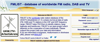
Right: The FmList is the starting point for every station photo tour…
Once you have found all the locations, you still have to find out what is being broadcast. Again, the sources mentioned above can help you with this or – if the sources do not provide an answer – you can try it on site.
In countries with functioning public databases, of course, you don’t need to go through all of these steps; here it is sufficient to proceed to the last ‘preparatory step’. You draw up a list of the locations you are going to visit. This can also take some time, as you still need to find the exact coordinates (unless you have a TomTom sat nav). Now you can set off on a transmitter photo tour (of which I do about 2-3 per year) or a trip that is combined with a transmitter photo tour (of which I do a little more per year).
C: The route to the transmitter site, capricious weather and the ‘ideal’ transmitter photo weather
Once you are on site, there are different ‘categories’ of transmitter locations, which also determine the mood. Ideally, there is a road to the locations or, if not, the route you have to take on foot has been researched beforehand. But theory is often not practice. Often either the researched data is poor or you make mistakes on site or have not correctly assessed the situation. Then transmitter photo tours can sometimes turn into adventures. The mast at ‘Dudelange/Ginsterberg’ in Luxembourg, for example, was misjudged due to its height and the distance was underestimated, resulting in an unwanted introduction to Luxembourg’s botany.
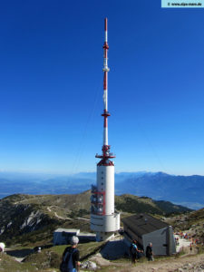
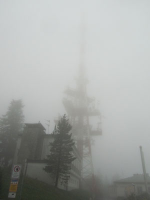
Sometimes the weather can spoil the mood. For example, on the Pfänder near Bregenz, where you could at best make out a mast thanks to the fog, or on the Großer Feldberg near Frankfurt, where there was also heavy rain. However, the tour at Sveti Jure in the Biokovo mountains near Makarska in Croatia took the crowning glory in terms of ‘bad weather’. Despite 15 kilometres of road, tolls and sunshine by the sea, there was thick fog at the top, which was also combined with strong winds. It became a ‘fight against the fog’, having to pull the trigger within a few seconds of the mast appearing in order to get a halfway decent picture and having to stand on this shitty mountain for 30 minutes in the wind and fog… Mountain had to stand…
But in most cases, roads or paths lead to the transmitter sites (although the quality of these sometimes leaves a lot to be desired). And in most cases the sun is (hopefully) shining. Incidentally, the perfect ‘transmitter photo weather’ is a deep blue sky and a high position of the sun – the best months for this are April to August.
D: transmitter photos and the breathtaking view – far away from the tourist crowds
As a transmitter site should cover as large an area as possible, it is usually located on a hill. And, of course, the height usually results in a corresponding view.
Of course, not all sites have a fantastic view, but you can assume that the majority do. During my visits to transmitter sites, I have often been able to enjoy unique views. The masts are often embedded in beautiful landscapes, where the ‘little bit of metal’ blends harmoniously into the scenery.
I particularly remember the Srd near Dubrovnik with its unique view of the beautiful Dalmatian city, Monte Nerone near Piobbico with a fantastic distant view of the Marche region or the Pecigrad site in the north of Bosnia/Herzegovina, where you can actually see ‘half the Balkans’.
Monte Caccia in Apulia or many small transmitters in Italy with a view of the Mediterranean are particularly scenic.
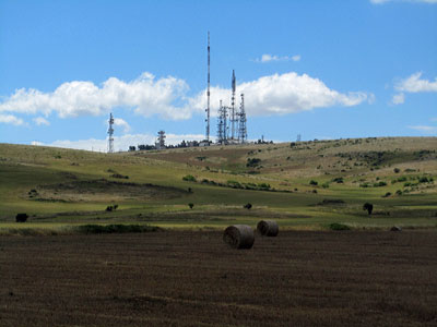
The best thing about these views is that they often remain hidden from the masses of tourists. You are usually all to yourself, can enjoy the view and capture it in photos for your memory. No annoying crowds of tourists around you, just the view and this moment. Travelling to the transmitter photo locations often takes you to areas where the ‘real life’ of the local population takes place and you unconsciously gain a deep insight into the way of life of the country you are in. Which, in my opinion, is what radio generally does, because the way in which advertising and programmes are presented, the music that is played, all this offers a deep insight into the soul of a people, the ‘radio scene of a country reflects the mentality of a country’.
Travelling here gives you an insight into the everyday life of the locals, gives you fantastic places with magnificent views and takes you far away from mass tourism.
E: Every transmitter site has its own history
As the reader now realises, there is much more to this hobby than a simple mast. It often stands in unique landscapes with great views, you learn something about the country and its people as well as its geography and topography, and you can better understand why a programme still arrives at home so far away.
Beyond that, however, there is another aspect that is very important to me. Every transmitter site, even the smallest one, has its own little story. Although I have photographed more than 500 transmitter masts all over Europe, I can remember my visit to all of them, really all of them.
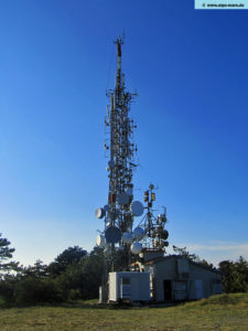
Koordinaten: 45° 51′ 28.76″ Nord, 13° 42′ 11.97″ Ost
Of course, a silo in Zagreb remains less dominant in my memory than, for example, the Trstelj site near Nova Gorica in Slovenia. I was accompanied from my car to the transmitter site by the dog from the local hut.
As I was unpacking my camera at the site, I saw that the dog had placed a large branch in front of my feet and was giving me a big look; he probably wanted me to throw the branch as a ‘stick’. Although I actually wanted to disappear again quickly after taking my photos, I changed my mind and – as I couldn’t resist the dog’s gaze – I threw the branch. And so it went again and again, throw branch – 1 photo – throw branch – 1 photo – until I was finished. Then the dog accompanied me back to the hut and its owner greeted me in a friendly manner before I set off for the next location.
These are experiences that you would hardly have as a ‘normal’ tourist. These experiences could fill entire books by now. Whether it’s narrow roads – or those that can no longer even be called roads due to potholes and rain washouts, such as the Ivanscica in Croatia – ‘special’ weather conditions (I’ve already reported on rain and fog, 3 metre high snow walls in May on the Lovcen in Montenegro or unintentional deep snow hikes on the Dobratsch near Villach) or stories like the ‘transmitter dog’ on the Trstelj, all of these are stories that you won’t forget in a hurry. One-way roads on Monte Cero near Baone or even roads without crash barriers, black ice like on Monte Subasio, potholes, supposed driving bans, barking dogs and owners, the military, ruins and even mines can all be encountered on transmitter tours.
There is still a risk of mines at some locations in Croatia…
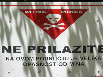
However, this is all compensated for by fantastic mountain landscapes combined with hikes through deciduous and coniferous forests, roads that lead along coastlines or gently undulating over hills and, time and again, dreamlike mountains and villages far away from tourists.
Many opportunities
In the end, it has to be said that transmitter photos are like life. You often experience moments of disappointment, anger, fear or worry, but then there are those situations where, high up on a mountain, in summer temperatures in a T-shirt, not a cloud in the sky, you photograph a mast with a deep blue sky and, for example, the sea in the background and you realise again why you are pursuing this hobby. A niche hobby that is so much more diverse than you might think.
There are always opportunities to take photos of transmitters – you just have to seize the opportunity.
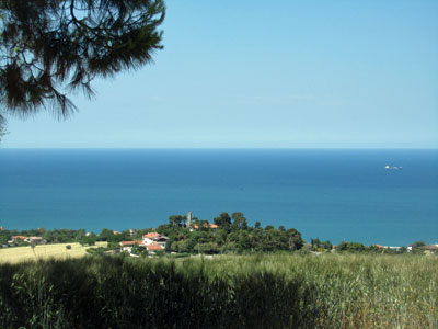
A proper transmitter photo tour alone would rarely be satisfactory. But with a little time management, you can combine a trip with the transmitter photos and then the balancing act between the two works really well. After you’ve taken the photos under a deep blue sky, you can look forward to a good pizza down in the village and maybe take a detour to the beach to immerse yourself in the sea once again.